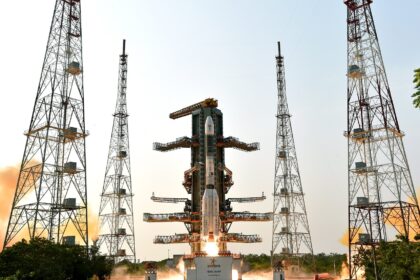
GSLV Mk II

Indian Space Research Organization | GSLV Mk II | NISAR (NASA-ISRO Synthetic Aperture Radar) Rocket Launch

The NASA-ISRO Synthetic Aperture Radar, or NISAR satellite, will use advanced radar imaging to map the elevation of Earth’s land and ice masses 4 to 6 times a month at resolutions of 5 to 10 meters. It is designed to observe and measure some of the planet’s most complex natural processes, including ecosystem disturbances, ice-sheet collapse, and natural hazards such as earthquakes, tsunamis, volcanoes and landslides.

Under the terms of the agreement, NASA will provide the mission’s L band synthetic aperture radar (SAR), a high-rate telecommunication subsystem for scientific data, GPS receivers, a solid-state recorder, and a payload data subsystem. ISRO will provide the satellite bus, an S band synthetic aperture radar, the launch vehicle, and associated launch services.

Posted on

Indian Space Research Organization | GSLV Mk II | IRNSS-1L (NVS-03) Rocket Launch

This is a replacement satellite for the Indian Regional Navigation Satellite System. The constellation will provide India with an alternative to GPS and will be used for military and civilian use. Located at a geosynchronous orbit, the system will be operated by the Indian government.